



A real-time location system promises to show where people, vehicles and assets are right now. Getting that promise onto a screen takes planning: the right tags, reader positions, network, software and rules for what happens when an item moves or goes missing. This guide follows a practical implementation from first goal to go-live.
Key takeaways
- Start with one clear question the system must answer.
- A site survey checks coverage, interference and where readers can be mounted.
- Tags, readers and software must fit together and suit the environment.
- Test coverage on site and agree who acts on alerts.
Step 1: Define what you need to know
Write the question in one line, such as “find any pallet jack within a minute” or “know when a forklift enters a restricted zone”. The goal fixes the accuracy, the number of tags and the update speed you need.

Step 2: Survey the site
Walk the areas to be covered and note walls, metal racks, vehicles and other sources of radio interference. Decide where readers or anchors can be mounted and powered, and where network cabling can run. Metal and moving vehicles often affect results, so test before you commit.
Step 3: Choose tags, readers and anchors
Select the technology to match the goal, as set out in RTLS technologies compared. Choose tags that suit the item, such as rugged tags for vehicles or small tags for tools, and check battery life and mounting.
Step 4: Set up the software and rules
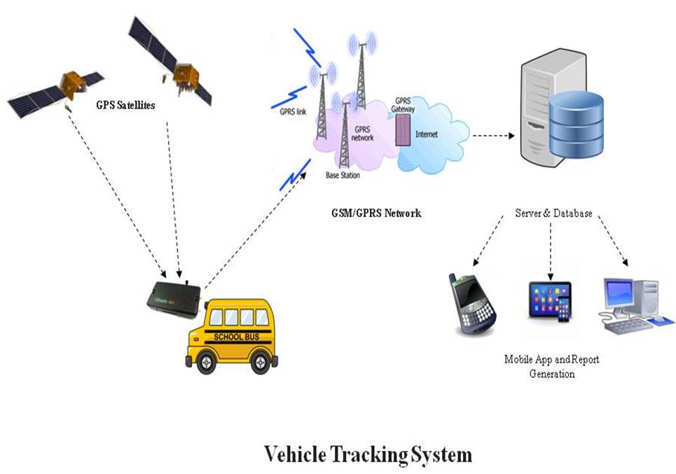
Create maps and zones, link tags to assets and set alerts, such as an item leaving a zone or a tag battery running low. Connect the data to systems such as the warehouse system or RFID asset tracking software so location data supports daily work.
Step 5: Test, train and review
- Walk the site with test tags and mark dead spots.
- Adjust reader positions and settings, then retest.
- Train users on the map, alerts and what to do next.
- Review after a month and add areas or tags.

RTLS survey and implementation by Suraj Informatics
Suraj Informatics surveys the site, supplies and installs real-time location systems and integrates them with your other systems. For related uses, see how RTLS works.
RTLS implementation: common questions
How long does RTLS implementation take?
It depends on the area, the technology and the integration. A survey gives a realistic plan.
Why survey the site first?
Metal, walls and interference affect coverage, so a survey shows where readers should go.
How many tags do we need?
That depends on the goal. Start with the assets or people that matter most.
Who should respond to alerts?
Agree this before go-live so alerts lead to action.
Talk to our RFID and RTLS team
Tell us what you need to track and how precisely, and we will suggest the right RTLS technology.